
by Rob | Sep 23, 2021 | Press release
Klau Geomatics recently featured in NovAtel Velocity magazine. Get some background on our company, our tech and our vision. Precise GNSS positioning is absolutely essential for today’s geomatics data gathering systems, whether air-based or ground-based, manned or...
by Rob | Jul 8, 2021 | Press release
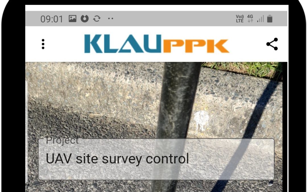
The Klau Geomatics KlauPPK hardware and software solution has been the choice of UAV survey professionals for many years. Now, with the KlauPPK Phone App, surveyors can leverage the KlauPPK hardware and software solution from their drone to do regular ground...
by Rob | Jun 28, 2021 | Press release
Between the worlds of high cost commercial manned aerial mapping and professional UAV mapping, lies an alternative of affordable and accessible large scale aerial mapping option. Using drones to capture long stretches of highway or vast expanses of detailed mapping,...
by Rob | Jun 13, 2021 | Press release
Surveying with Drones and Managing Errors What surveyors live and breathe is error management, so let’s jump to the key points. Surveyors need to check their work. Beyond knowing if it is right or wrong, they need to measure how well they are measuring. Surveying...
by Rob | Jun 10, 2021 | Press release
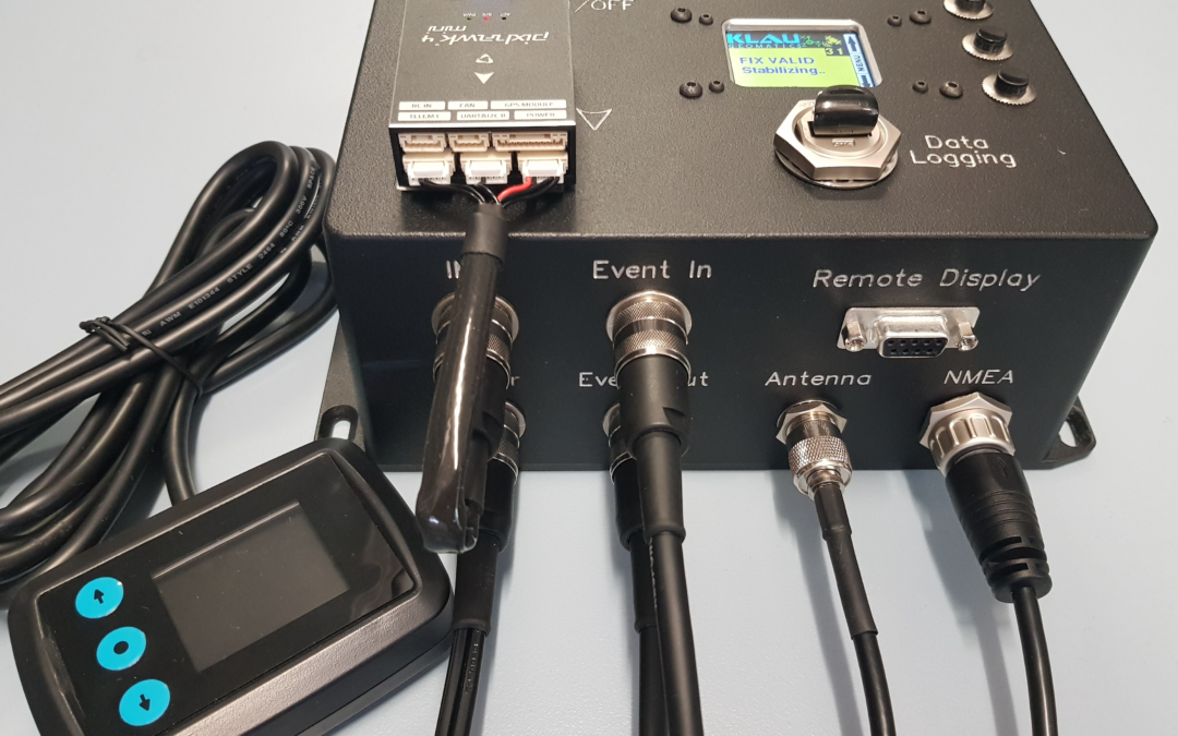
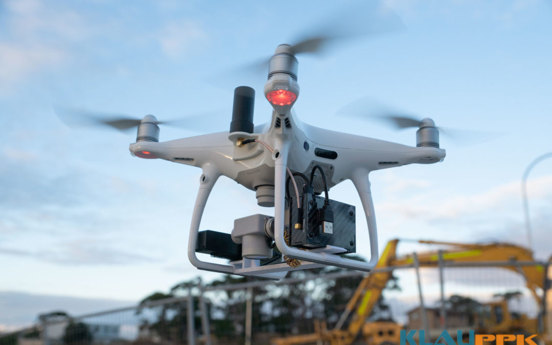
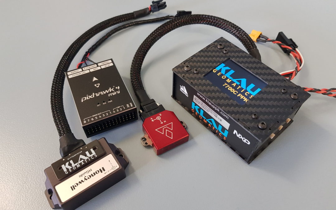
KlauPPK: Central to Accuracy in Open UAV Ecosystem KlauPPK has been the go-to product for survey accuracy on drones since 2015. Now, as the industry starts to move away from the DJI monopoly to a more open architecture, the KlauPPK hardware and software solutions are...
