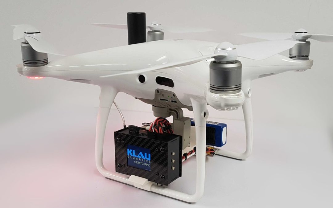
by Rob | Feb 11, 2021 | Press release
Surveying Industry Set For A Shake Up with Affordable Drone Bundle When combined the KlauPPK and DJI Phantom4Pro become the most capable, light mapping drone on the market. NOTE: Unfortunately this bundle is no longer available as the P4Pro is discontinued. If you are...
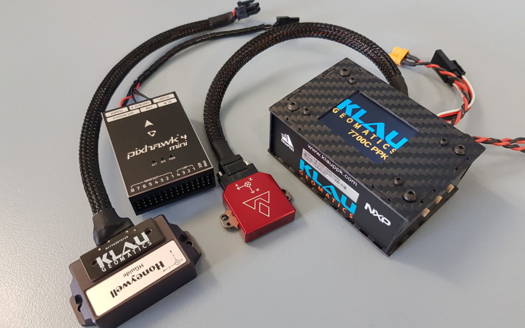
by Rob | Nov 24, 2020 | Press release
Klau Geomatics is releasing the 7700C integration platform, a GNSS hardware system designed to integrate with external IMUs and IoT devices. The KlauPPK hardware/software product has been an industry leader in aerial mapping for over 5 years, with ongoing improvements...
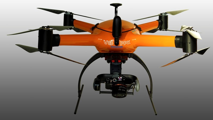
by Rob | Oct 16, 2020 | Press release
With the release of the new CONDOR V8-PPK mapping drone, Munich (Germany) based Videographics Ingenieurgesellschaft mbH has built the tool for precise photogrammetric aerial mapping and surveying projects. Introducing the CONDOR V8-PPK mapping drone, developed by...
by Rob | Oct 1, 2020 | Press release
Japan’s Ministry of Land, Infrastructure, Transport and Tourism have re-written their UAV capture specifications based on results using KlauPPK technology. The Guideline for work-type management using aerial photogrammetry (earthwork) specifies the procedures to be...
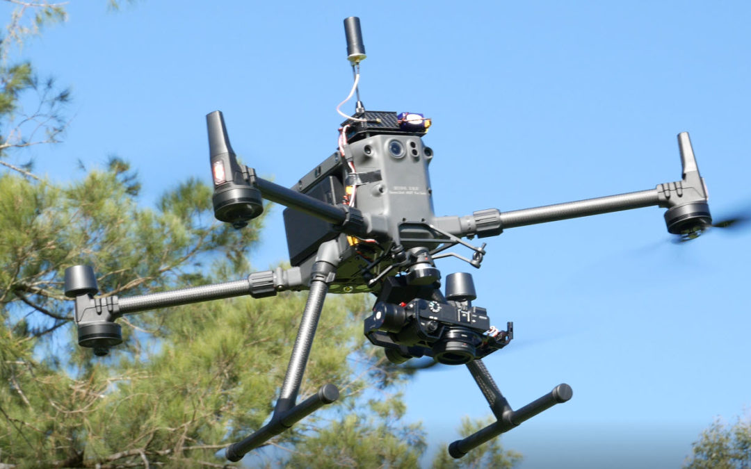
by Rob | Jul 10, 2020 | Press release
The M300 has hit the ground running with rave reviews on its capabilities. It features long flight time, good payload capacity, many refinements that I am sure you have read about if not seen in person. The inspection camera is a game-changer, with RGB, thermal and...
