by Rob | Jun 13, 2021 | Press release
Surveying with Drones and Managing Errors What surveyors live and breathe is error management, so let’s jump to the key points. Surveyors need to check their work. Beyond knowing if it is right or wrong, they need to measure how well they are measuring. Surveying...
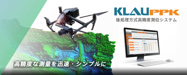
by Rob | Jun 10, 2021 | Press release
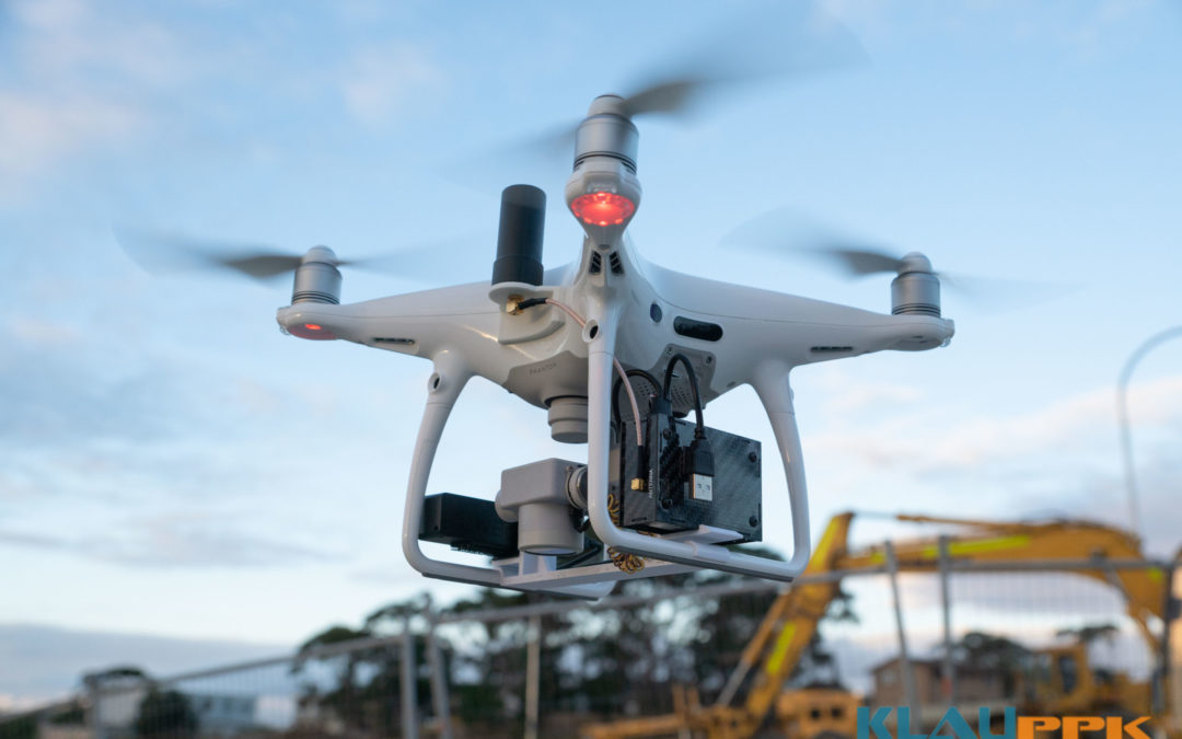
KlauPPK: Central to Accuracy in Open UAV Ecosystem KlauPPK has been the go-to product for survey accuracy on drones since 2015. Now, as the industry starts to move away from the DJI monopoly to a more open architecture, the KlauPPK hardware and software solutions are...
by Rob | Feb 11, 2021 | Press release
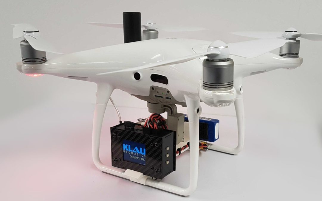
Surveying Industry Set For A Shake Up with Affordable Drone Bundle When combined the KlauPPK and DJI Phantom4Pro become the most capable, light mapping drone on the market. NOTE: Unfortunately this bundle is no longer available as the P4Pro is discontinued. If you are...

by Rob | Nov 24, 2020 | Press release
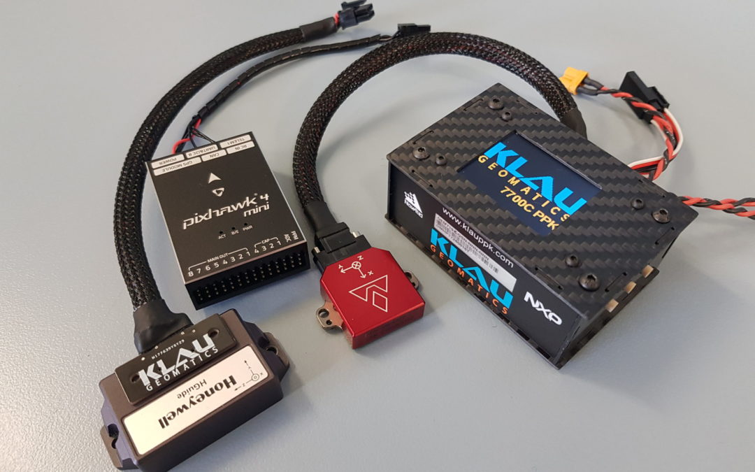
Klau Geomatics is releasing the 7700C integration platform, a GNSS hardware system designed to integrate with external IMUs and IoT devices. The KlauPPK hardware/software product has been an industry leader in aerial mapping for over 5 years, with ongoing improvements...
by Rob | Oct 16, 2020 | Press release
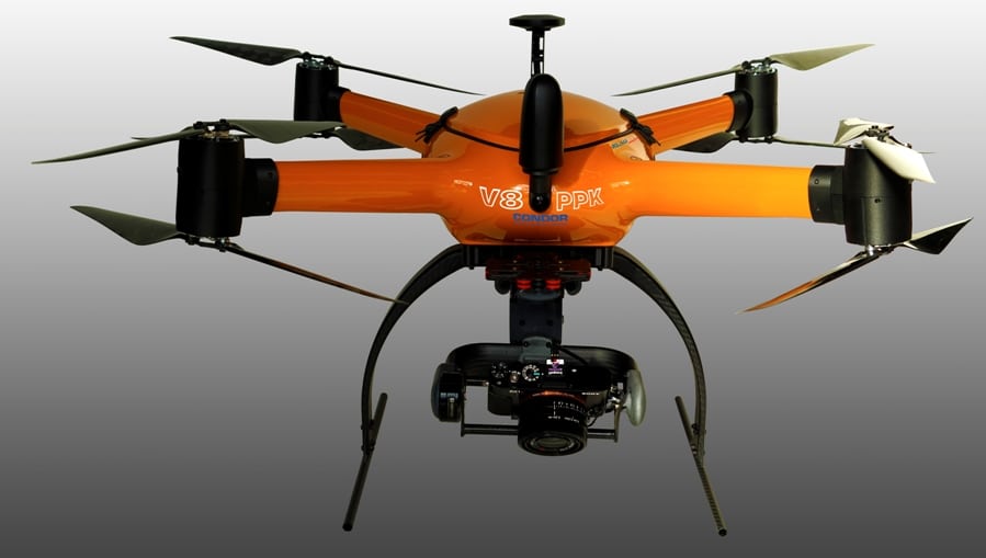
With the release of the new CONDOR V8-PPK mapping drone, Munich (Germany) based Videographics Ingenieurgesellschaft mbH has built the tool for precise photogrammetric aerial mapping and surveying projects. Introducing the CONDOR V8-PPK mapping drone, developed by...
by Rob | Oct 1, 2020 | Press release
Japan’s Ministry of Land, Infrastructure, Transport and Tourism have re-written their UAV capture specifications based on results using KlauPPK technology. The Guideline for work-type management using aerial photogrammetry (earthwork) specifies the procedures to be...
