AERIAL SENSOR PAYLOADS
-
Task-specific sensor combinations
-
Controller + LiDAR + Cameras
-
Over floor holes or in a Klau Geomatics pod
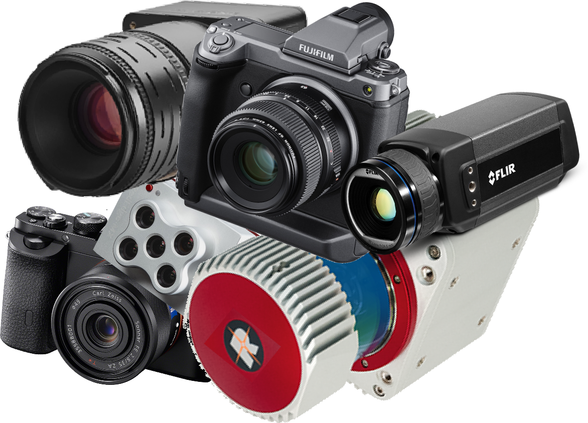
Klau Geomatics Survey Controllers are are built on NovAtel 7 Series GNSS
Ruggedised, accurate georeferencing, GNSS or INS, to integrate with sensors and FMS
Every Klau Geomatics positioning system, has an industry-leading NovAtel 7700 board at its core, military spec, with advanced interference mitigation, tested over millions of hours.
The positioning system is at the heart of every payload, the key to integration and accuracy.
Brumby Controller
Fully equipped with high-spec INS positioning, data logging and sensor control including LiDAR.
-
Dual Receiver NovAtel 7 Series GNSS , IMU, SPAN INS
-
Full INS with RTK or TerraStar-C Pro PPP, real time or post processed trajectory and orientation for multiple sensors
-
Control Brumby LiDAR and external sensors such as cameras from Fuji and PhaseOne, multispectral, hyperspectral
-
Real time or post processed trajectory and orientation values for other sensors on the aircraft
-
Send PPS, NMEA and event marks to sensors and flight management systems
-
time or distance camera triggering

Basic Manned System
Our trusty original manned system, well suited to single or dual camera configurations, to create accurate camera centre coordinates.
-
NovAtel 7 Series GNSS with PixHawk IMU for lever arm corrections
-
Supports PPK and ‘no-base-station’ PPP/PPK, real time or post processed
-
time or distance camera triggering
-
Accurate camera centre positioning for DSLRs, medium format cameras and other sensors.
-
Send PPS, NMEA and event marks to sensors and flight management systems

AISPECO Mapping System
For complex payloads with multiple sensors the AISPECO system is recommended and supported by Klau Geomatics
-
Combine up to 9 sensors
-
Dedicated controller to manage and log sensor data
-
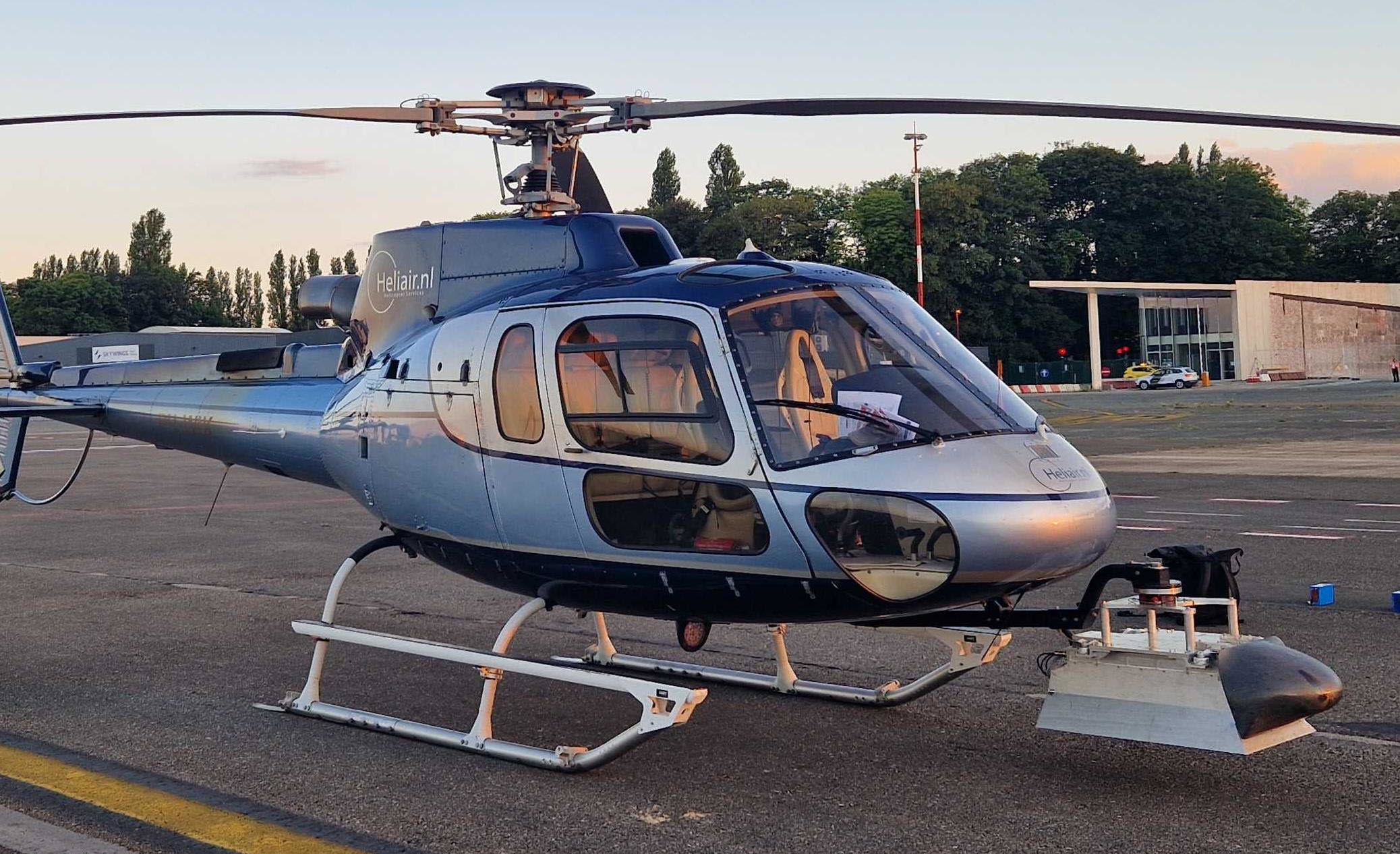
In-aircraft or pod installations
-
Integrated Aispeco FMS

Aerial Mapping Cameras
Integration with PhaseOne and Fujifilm medium format cameras
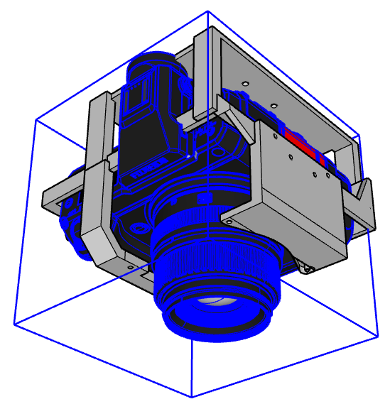
The Brumby or Basic Controller will manage your DSLRs or medium format cameras such as PhaseOne and FujiFilm.
-
Produce accurate camera centre coordinates
-
NIR-modified cameras, PhaseOne, Fujifilm, Sony
-
Infinity lock for Fujifilm GFX-100
-
Exoskeleton for Fujifilm GFX-100 and other cameras to replicate PhaseOne mounts
-
Mount in Keprey Pod with nadir and oblique tilts
LiDAR
See the Brumby LiDAR page for details
Pre-configured and custom sensor bundles
Sensor combinations, positioning and workflows for specific applications
The Klau Geomatics Brumby Controller works with your sensors, FMS and workflow to add high-accuracy Direct Georeferencing.
-
RGB cameras, PhaseOne, Fujifilm, with calibrated lenses
-
NIR-modified cameras, PhaseOne, Fujifilm, Sony
-
LiDAR from Hesai, Riegl, Ouster and others
-
Multispectral, Hyperspectral & Thermal cameras
-
Gravity, Magnetics, EMR, and other geophysics sensors
FAST MAPPING PAYLOAD
A simple economical solution for efficient capture of photogrammetry data for typical aerial mapping.
Excellent for mine site surface captures for volume measurement, site planning and engineering.
Produce accurate pointclouds, terrain models and orthophotos.
-
-
-
Basic Manned System GNSS
-
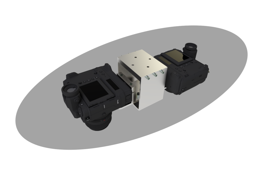
2 x modified Fuji GFX100 cameras, infinity locked and stabilized, 60mm lens
-
shock mounting over hole or in pods
-
customizable
-
-

Typical mission parameters:
– Flight height – 2000 ft
– GSD – 3.8 cm
– photo per sq km – 35 (photo pairs)
– capture time per sq km – 1 minute
ECO MAPPING PAYLOAD
4-Band data for agricultural and environmental mapping capture to produce accurate farm terrain models, orthophotos and data for remote sensing analytics.
-
-
-
Basic Manned System GNSS
-
1 x modified Fuji GFX100 camera, infinity locked and stabilized, 60mm lens
-
FujiFilm GFX100 with NIR modification, infinity locked and stabilized, 60mm lens
-
-
Typical mission parameters:
– Flight height – 2000 ft
– RGB and NIR(Fuji) – 4 cm GSD
– photo per sq km – 56
– capture time per sq km – 1.6 minutes
SCANNING PAYLOAD
A sophisticated solution to capture accurate pointcloud data in a single low pass in a light aircraft.
-
Brumby Controller, NovAtel SPAN GNSS/IMU for high accuracy direct gereferencing
-
Brumby LiDAR to capture terrain, power lines and vegetation
-
1 modified Fuji GFX100 camera, infinity locked and stabilized
-
Other camera options, thermal, NIR, hyperspectral…
-
Shock mounted over floor hole or in pod
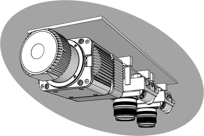
Typical mission parameters:
– Flight height – 500 ft
– Pointcloud density – 80 pts/sqm
– capture rate – 110 kmph
The system that’s right for you.
We can configure the sensor suite, controller, positioning, FMS and approved aviation mounting.
The Klau Geomatics sensor payload can be incorporated into your current system or be part of an entire system built for purpose.
-
Shock mounted racks for floor holes
-
Wing strut pods
-
Aircraft modifications and compliance
-
Complete airaft with flight management, sensors, georeferencing and data management.
Configure your Klau Geomatics system.
Contact us to discuss a system
for your requirements.
