KlauPPK: Versatile, with More Data, More Accuracy, More Options
by Rob | Dec 12, 2019 | Press release


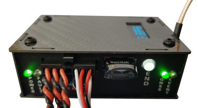
Klau Geomatics, manufacturer of the KlauPPK system, has released a new hardware system that offers increased versatility in accurate positioning for UAV and manned aerial mapping. KlauPPK offers more versatility; the modular design can move between drones, cameras and modes of operation, PPK, PPP real time and PPP post processed.
More Data Equals More Options
All KlauPPK hardware now captures full constellation GNSS data; technology powered by NovAtel OEM7 multi-frequency boards. More satellites are tracked simultaneously with advanced noise and multipath mitigation. If a signal is blocked in the working environment, the receiver will simply pick up a signal from another constellation, ensuring solution continuity. Data is logged on the aircraft and is not affected by losses experienced due to RTK radio link and range limitations.
The larger volume of high-quality captured data opens up opportunities for enhanced PPK processing for harsh environments, near real time PPP processing and real time PPP streaming.
PPK. Users of KlauPPK hardware can always process their data as PPK, with base station data they collect or download. The new full constellation option enables stable, accurate PPK positioning in harsh environments such as the base of a headwall with limited sky view.
Autonomous Accuracy, Near Real Time
PPP NRT. The same PPK data can now also be processed as PPP, without any base station data input. The Klau Geomatics near-real-time positioning solution (NRT) integrates global satellite corrections to process the raw GNSS data without any base station data or network RTK. No base station range limits, this system works everywhere.
This is an incredible solution for enterprise customers looking for one system that will work anywhere in the world, regardless of proximity and access to a local base or CORS data. Manned aerial systems can map dispersed remote projects without any base station considerations.
The NRT corrections are available shortly after the mission, via the KlauPPK desktop software. The KlauPPK software also applies smart photo synchronization logic, 3D dynamic lever arm corrections, coordinate transformations, geoid models and site localizations.
Autonomous Accuracy, Real Time
PPP RT. For those applications needing immediate real-time high precision, the Real Time PPP option offers precise positions that can stream directly to a sensor or flight management system. This enables precise real time navigation for applications such as drone delivery or real time data applications. These solutions are compatible with most quality cameras on UAVs or manned aerial systems.

