by Rob Klau | Apr 24, 2024 | Press release
Over the past decade mine surveying has radically changed with drones playing a big role in mine mapping and volume determination. Photogrammetry with drones has brought efficiencies that have changed the way mines are measured and managed. Now, technology is...
by Rob Klau | Feb 24, 2024 | Press release
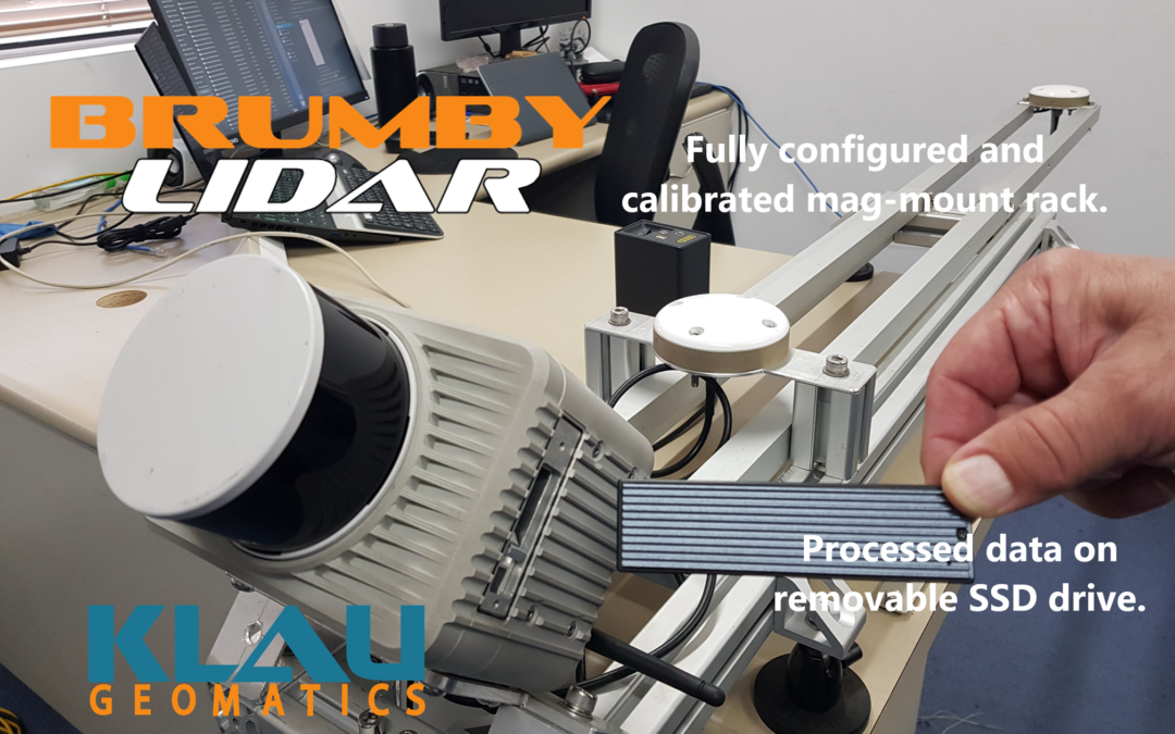
As published in LiDAR News The Klau Geomatics Edge Compute ‘Brumby’ LiDAR generates live, accurate georeferenced point clouds. No post processing is required. The data is produced with geospatial coordinates at the speed of capture on the device. This groundbreaking...
by Rob Klau | Feb 22, 2024 | Press release
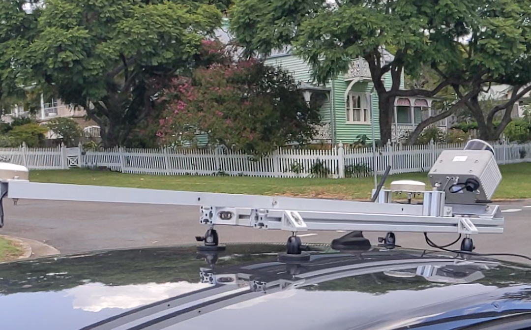
Klau Geomatics continues to break new ground in geospatial technology. The Brumby LiDAR introduces live georeferencing – no post processing. Nowra, Australia (Feb. 20, 2024) – Klau Geomatics has released the Brumby RTK LiDAR, a mobile mapping system with powerful Edge...

by Rob Klau | Nov 10, 2023 | Press release
Klau Geomatics has unveiled the StockPiler bulk asset measurement system, which provides accurate stockpile measurement on demand, without the need for deploying resources such as survey teams or drone operators. Previously, inventory levels could change in the time...

by Rob Klau | Oct 13, 2023 | Press release
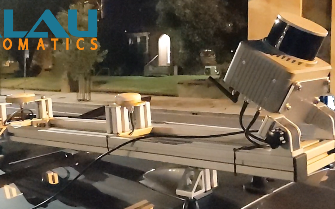
The Edge Compute Brumby LiDAR is making waves in MLS, airborne geophysics and powerline scanning with its accuracy and minimal workflow. The data from the device is processed into an accurate georeferenced pointcloud in just minutes, removing the typical LiDAR...
by Rob Klau | Mar 17, 2023 | Press release
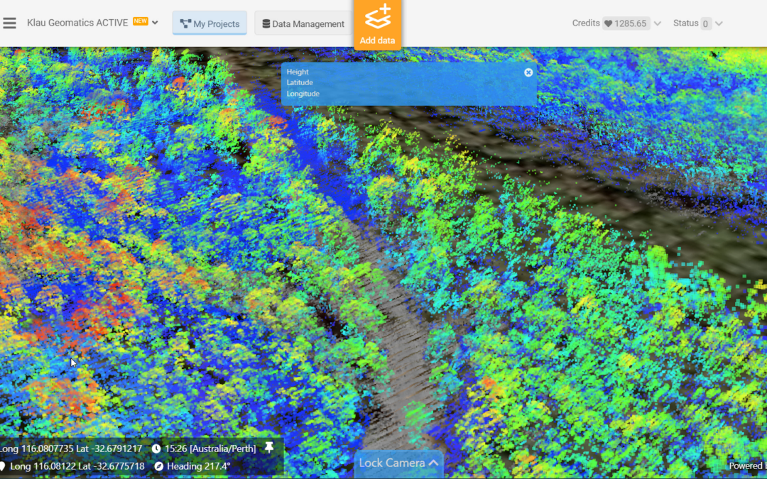
The test: to create accurate ground surface mapping, through vegetation, at 250 km per hour. The Klau Geomatics Brumby LiDAR was put to the test over the South Danalup forest, east of Perth, Western Australia. Flown in a Cessna Caravan at 135 knts (250 km/h), 300 ft...
