Stahly Engineering (USA) has provided engineering services in the fields of transportation, site development, water and wastewater systems, and structures since 1970. They recently deployed the KlauPPK geo-positioning system on their DJI Inspire2 drone to increase productivity, accuracy and efficiency in their field surveying operations.
UAVs are widely used in engineering, surveying and construction projects for collecting and producing survey data. However, surveyors had to spend hours putting ground control points across the site or use expensive RTK/PPK enabled drones. Now, with the KlauPPK system, there is a simple solution that plugs onto most drones to provide superior mapping accuracy with less time in the field.
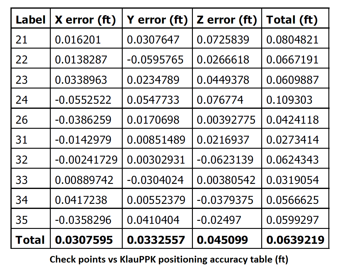
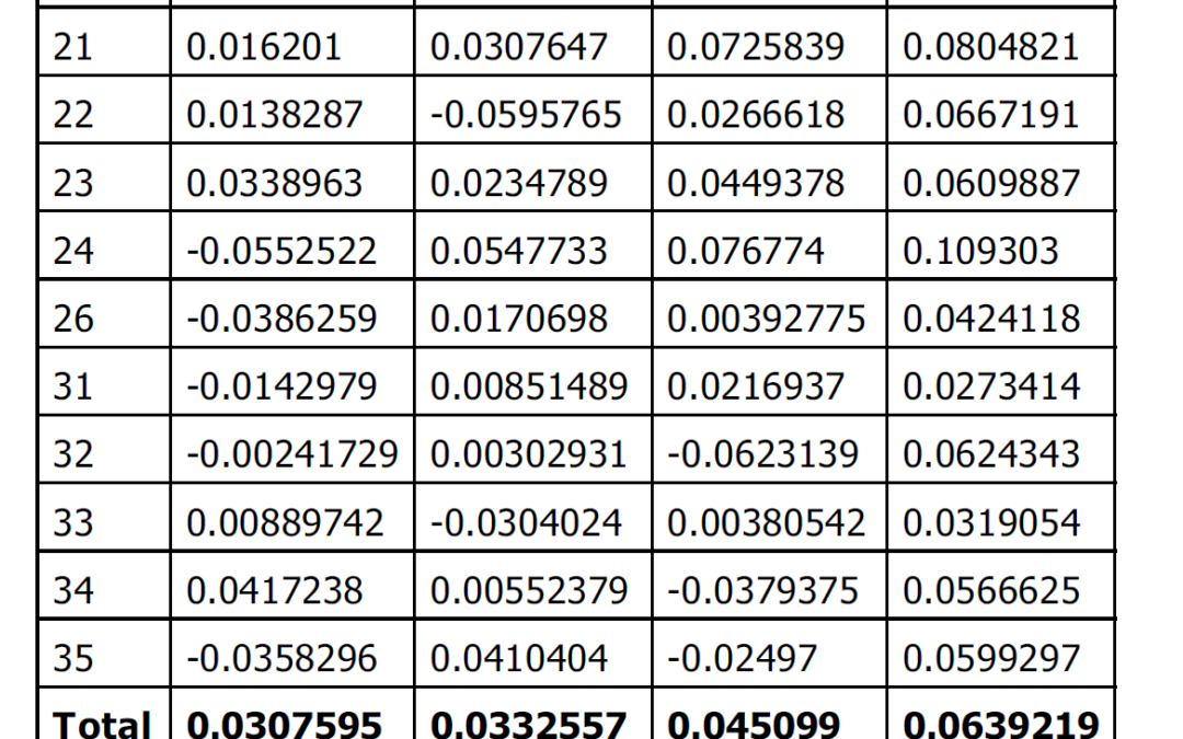
The experienced surveyors from Stahly achieved 0.04ft (1.2cm) accuracy in XYZ on the ground using their DJI Inspire2 drone equipped with the KlauPPK kit.
The key for this level of accuracy is precise centre of exposure capture, correcting for aircraft tilts and using a pre-calibrated camera. The system is packaged as a simple to use plug and play hardware and software kit. The advanced post-processing and geo-tagging software enables drones to seamlessly collect data in a local or global coordinate system and datum.
As well as huge time savings in the field, this direct georeferenced data, when applied to the customers regular photogrammetry workflow, helps save even more time by increasing data processing efficiency.
Klau Geomatics is delivering the world’s most accurate PPK positioning product to the drone surveying industry by conducting continuous R&D and introducing ground breaking new technology. Drone surveying is now highly accurate, repeatable and reliable, thanks to Klau Geomatics technology.
For more information visit https://klauppk.com

