
Over the past decade mine surveying has radically changed with drones playing a big role in mine mapping and volume determination. Photogrammetry with drones has brought efficiencies that have changed the way mines are measured and managed.
Now, technology is shifting, LiDAR is in demand as a more efficient way to capture terrain models for volume calculations, mine surveying and asset management.
But, are drones still key to this process? Possibly not. They may even be a liability.
Consider a typical mine survey for volume audits. What if you could capture the site, with an accurate data set, by just driving it. Drive past your drone crew still setting up to fly a patch of the mine, as you head to the office with your processed accurate georeferenced point cloud onboard, ready for your volume calcs.
Don’t put your expensive sensors at risk on a drone. Yes they can crash, and that expensive LiDAR scanner will go with it.
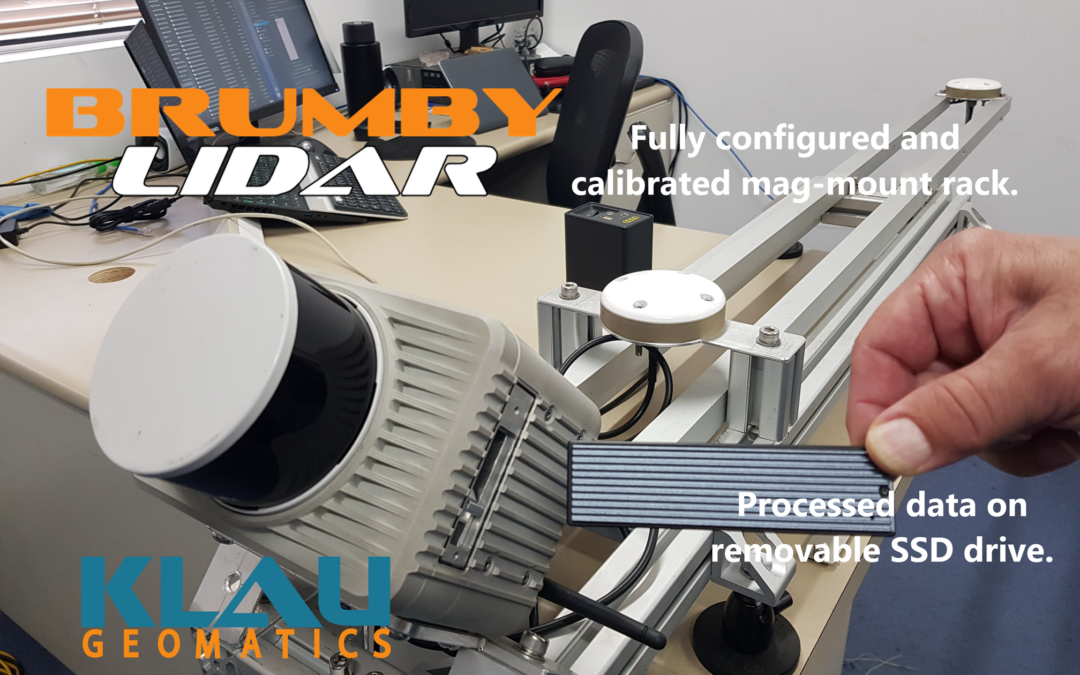
Klau Geomatics have been working in this space since the early days of drones in mining and have led the technology boom with accurate aerial positioning systems for photogrammetry on drones. Klau Geomatics again leads the world with the Brumby LiDAR, an edge compute device that produces point clouds with cm level ABSOLUTE accuracy (not just relative accuracy like SLAM systems).

Immediate data. Edge Compute. Unlike other LiDAR systems that log raw data to be processed, the Brumby computes an accurate georeferenced point cloud on the fly. Your data represents the state of your assets NOW, not from days ago after post processing. And being georeferenced you can compare this data with that of yesterday or tomorrow to measure change over time.
Drones have brought LiDAR tech to our attention, there is a strong association with LiDAR and drones. The Brumby could go on a drone, it works great on drones and manned aircraft, helicopters and boats. But, why not just put it on the roof of your truck?
Save time in the field on data capture, just drive your site.
Then save time in the office, the data is already processed, ready to compare to previous scans for precise volume measurements. With data acquisition this fast and effortless, you may want to capture your site more often, synchronise your materials audits daily and know what is going on immediately.
Fast, simple, accurate, cost effective, low risk, high return, immediate data, no processing, no data logjams, no drones… Give the Brumby Mobile Laser Scanner some thought. It is likely to make a big difference in your workplace.